Torrents of Change

A climate scenario study exploring Rosario, Argentina's vulnerability to extreme rainfall events — and the urban planning tools that may need rethinking in a changing world.

By Azucena Ospina, Pruethicheth Lert-udompruksa, Nagendran Muthusamy Arumugam & Siddharth Nambiar
Published April 19, 2024
Course MaCT01 23/24 · Landscapes in Transition

Act I · The Threat

Shorter & Sharper Events

Imagine the persistent drumming of rain against your window. Not the comforting tapping of a spring shower, but a relentless torrent that seems to prolong for days. This isn't science fiction, but a glimpse into the potential future of many Latin American cities.
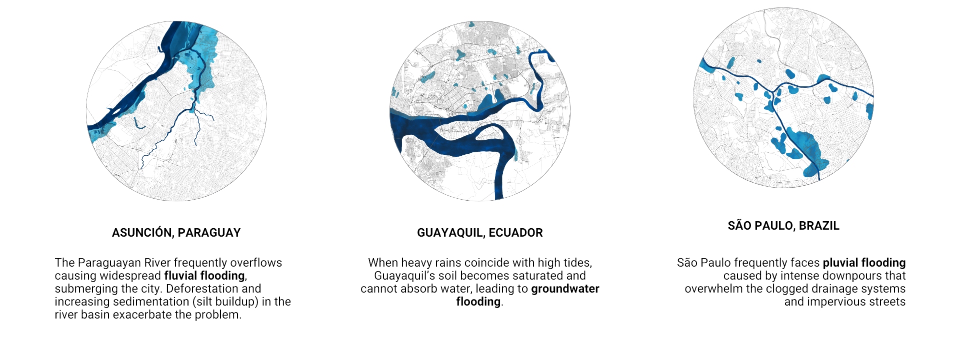
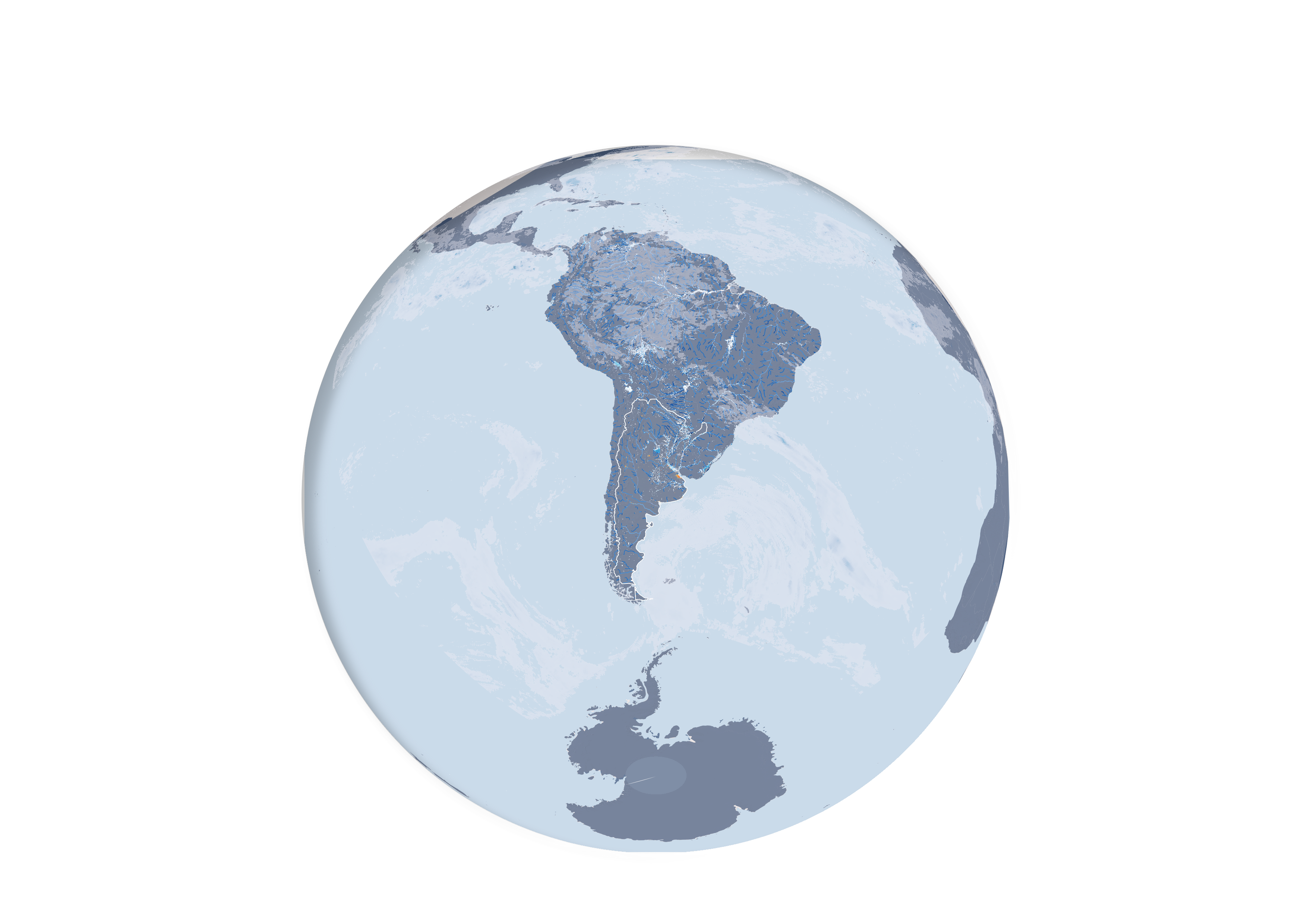
Latin American cities at flood risk — Asunción, Guayaquil, São Paulo

Cities at risk · Asunción · Guayaquil · São Paulo

40%

of the region is already at risk of flooding1

Latin American cities face a stark reality — metropolises like São Paulo (pluvial floods), Asunción (fluvial floods), and Guayaquil (groundwater floods) are already grappling with this harsh flooding crisis.

¹ UNDRR Special Report on Latin America

Seasonal Extremes

Heavier Wet. Harsher Dry.

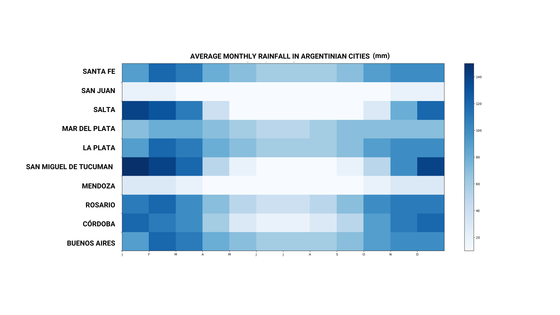
Now, take a look at Argentina's rainfall patterns. Notice how the precipitation concentrates heavily at the beginning and end of the year, leaving the rest of the months relatively dry. Climate change is projected to intensify these extremes — heavier rain during the wet season, followed by longer, harsher droughts.

This project explores the case of Rosario, Argentina, under an extreme weather event — intense and prolonged rainfall — to see how it would cope. But the purpose isn't just to paint a scary picture; this serves as a springboard to identify existing urban planning and architectural tools that might become obsolete in the face of a changing climate.

Act II

A City on the Edge

Rosario sits on a slight natural elevation beside the Paraná River — a geographic quirk that has historically shielded it from river overflows, but leaves it exposed to a different threat.

Act II · A City on the Edge

Rosario, Argentina

Home to approximately one million people, Rosario is Argentina's third-largest city. It sits at a slightly higher elevation relative to the Paraná River floodplain, which has historically spared it from the river overflows that periodically inundate neighbouring lowlands. Yet this advantage is only partial.

Pluvial Flooding

When the Drains Overflow

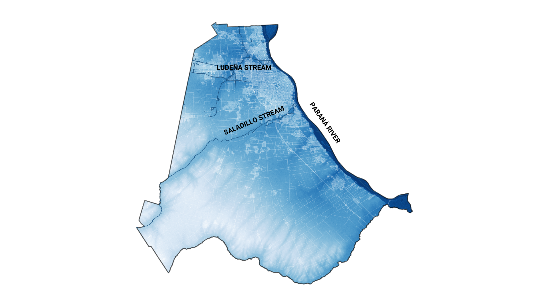
Rosario's primary flood risk is pluvial — caused by heavy downpours that overwhelm the city's drainage infrastructure. The Saladillo and Ludueña streams, which flow through the urban fabric, can transform into torrents during intense rainfall events, inundating low-lying residential neighbourhoods with little warning.

The Great River

The Paraná River

The Paraná is one of South America's great rivers, draining a basin second in size only to the Amazon. It defines Rosario's western edge — a dynamic, ever-shifting boundary between city and floodplain that has shaped the urban form, culture, and economy of the region for centuries.

Remote Sensing · Sentinel-1

Mapping the Floods

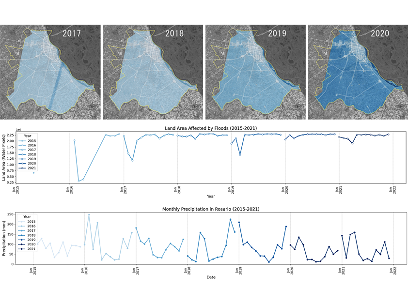
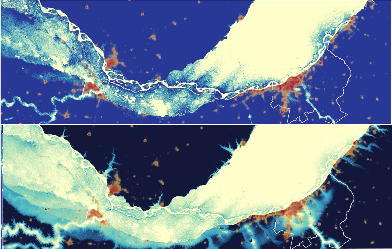
Using Google Earth Engine with Sentinel-1 GRD SAR data from 2015 to 2021, combined with speckle filtering and change-detection algorithms, the team produced a time-series flood-detection analysis.

"The data illustrates a discernible pattern of seasonal rainfall peaks in Rosario, potentially coinciding with summer months. Notably, there's a clear correlation between periods of intense precipitation and the incidence of floods."

Act III

Torrents of Change

What happens when a century-scale rainfall event meets a city unprepared for it? The scenario unfolds across scales — from regional migration to street-level survival.

Act III · The Storm

A Curious Position

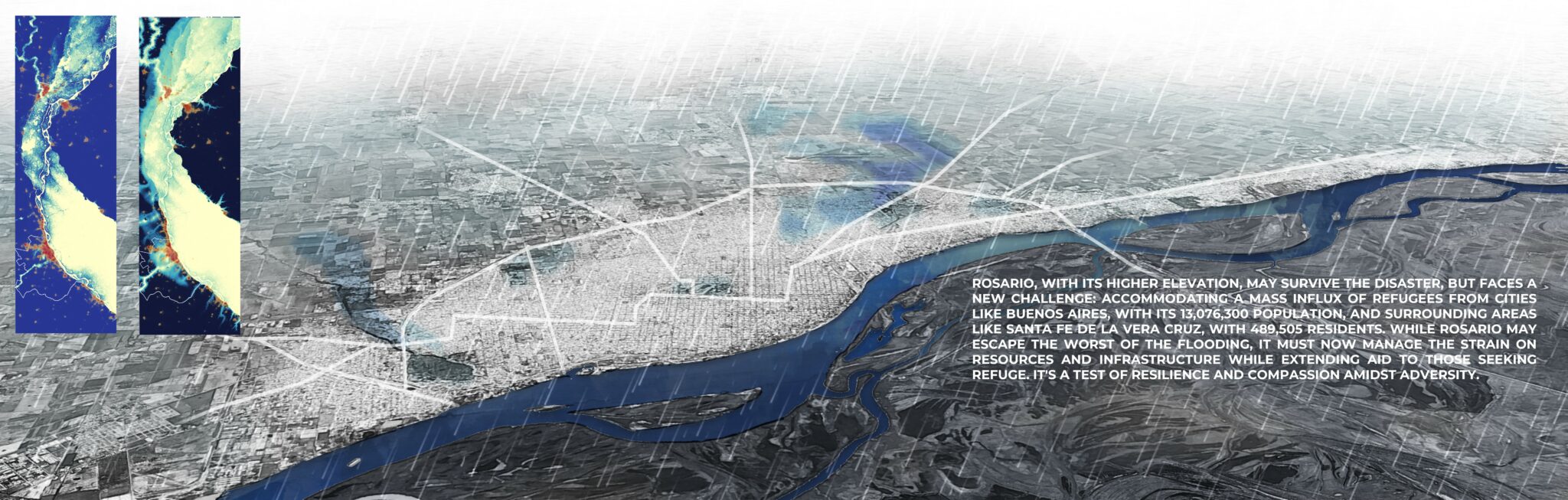
As climate change intensifies, rain events in Rosario might position it in a curious position. While surrounding areas, like the lower-lying Buenos Aires, could face even greater challenges, Rosario might become a relatively safe haven. This potential for in-migration adds another layer of complexity to the city's flood risk equation.

Existing mitigation efforts — drainage improvements, flood control infrastructure, and early warning systems — may be overwhelmed by the scale of a truly extreme event, forcing a fundamental rethink of urban resilience.

Regional Population at Risk

Displacement Pressures

13M+
Buenos Aires
490K
Santa Fe

While Rosario may evade the brunt of the flooding, it must grapple with the strain on resources and infrastructure while providing assistance to those in need from the wider region.

Parametric Analysis

Mapping the Vulnerable Pockets

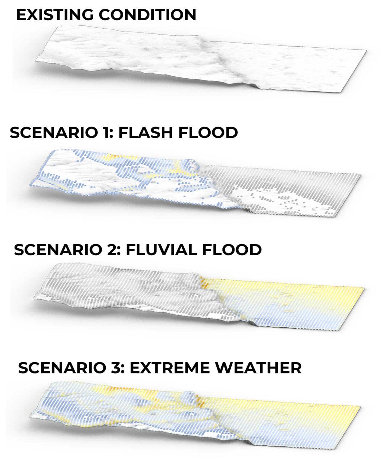
Grasshopper parametric simulations were used to analyse the terrain in detail, pinpointing the low-lying pockets most susceptible to waterlogging and inundation.

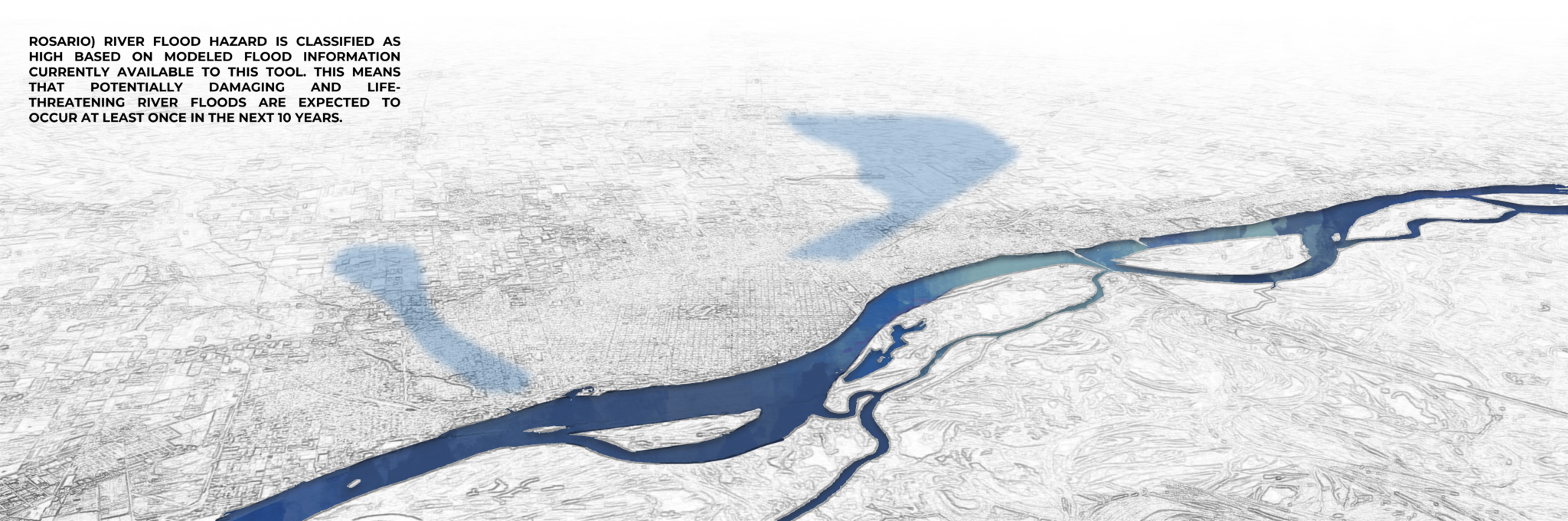
River flood hazard across the study area is classified as high — indicating a significant risk of potentially damaging and life-threatening flood events at least once within the next decade under current climate trajectories.

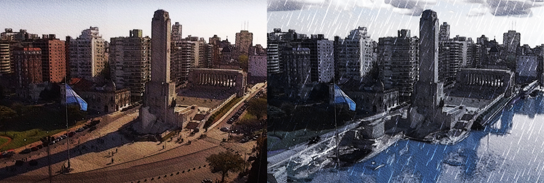
Apocalyptic storms unleash havoc upon low-lying regions and river cities like Buenos Aires and Rosario, transforming them into inundated flood zones. Feeble defenses are no match for the torrents of water that inundate streets within mere minutes. As rivers burst their banks, entire neighborhoods are swallowed by the deluge, leaving destruction in their wake. Despite efforts to fortify defenses and issue warnings, the specter of flooding casts a dark and ominous shadow over these vulnerable cities, perpetuating the imminent danger and uncertainty that looms large.

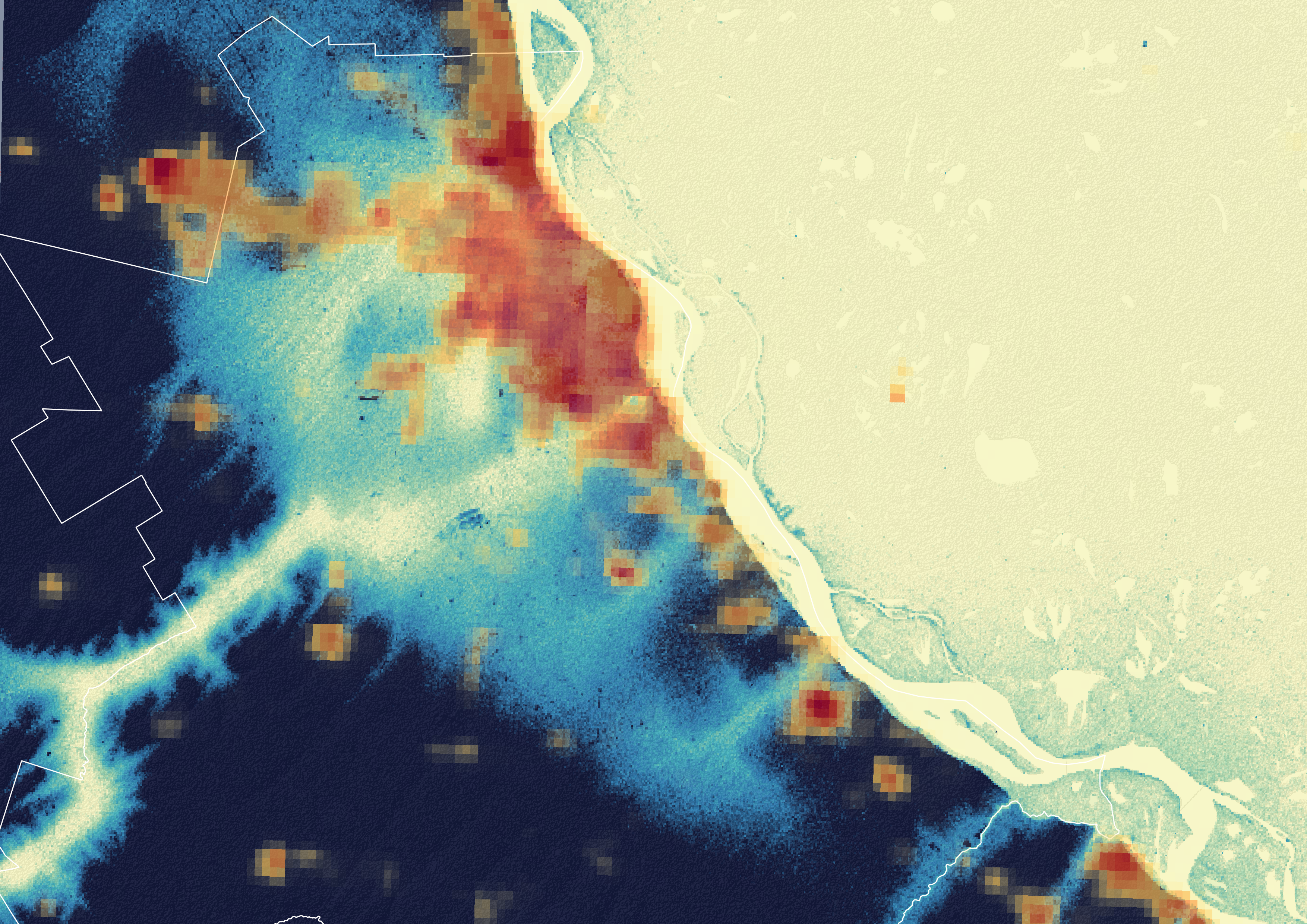
Rosario existing flooding condition

Existing Condition

Current flooding patterns along Rosario's drainage network and stream corridors.

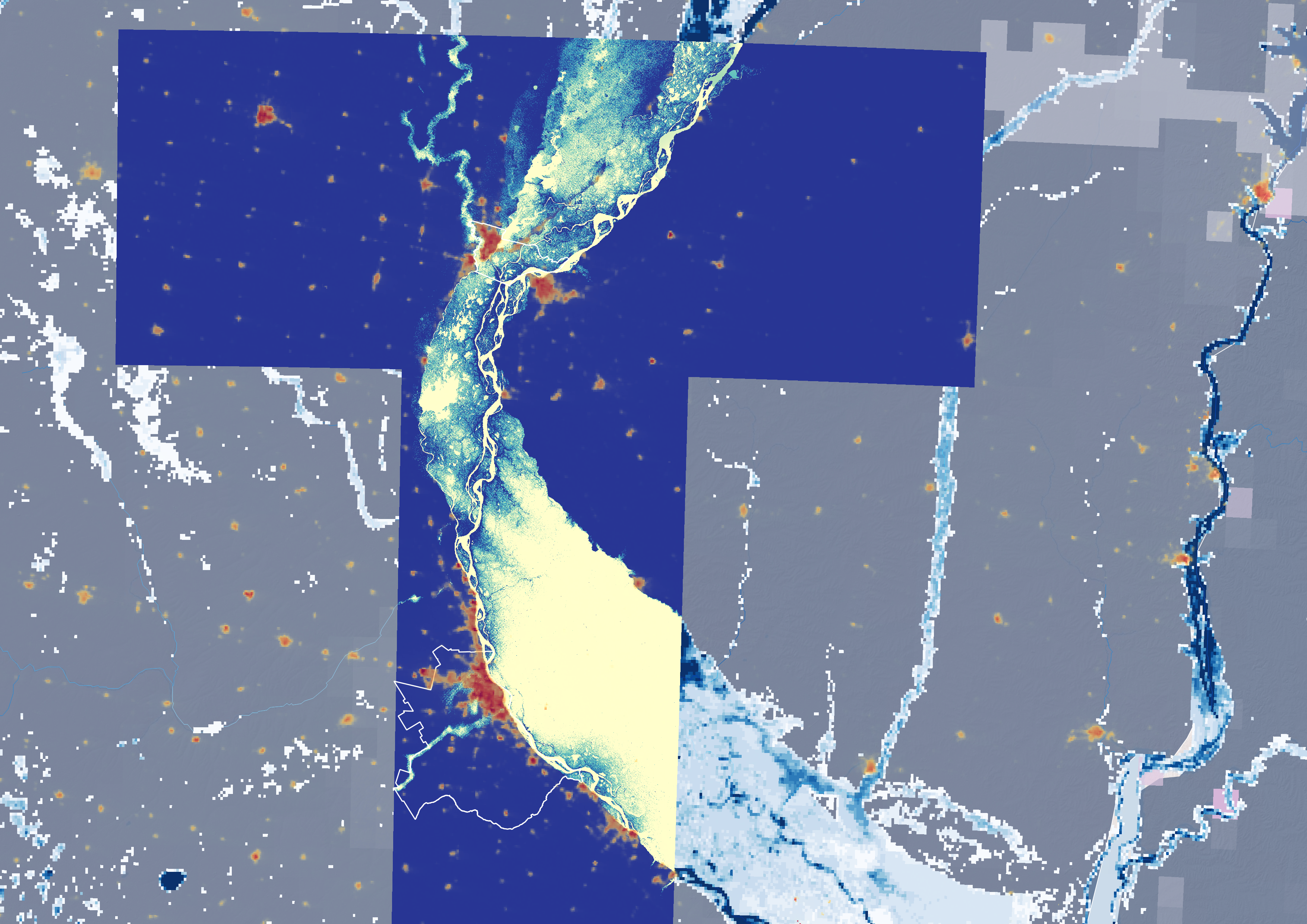
Rosario under extreme flooding

Scenario · Extreme Flooding

Rosario and the wider Paraná corridor under a century-scale extreme rainfall event.

Rosario and the Santa Fe region under projected extreme flooding conditions, 2050 scenario

Scenario · 2050

Rosario and the Santa Fe region under projected extreme flooding conditions.

Animation showing progressive inundation of the Rosario floodplain

Simulation · Inundated Floodplain

A time-lapse simulation of the floodplain under progressive inundation — tracing the sequential expansion of flood extent as rainfall accumulates beyond drainage capacity.

Act IV

Rethinking the City

Understanding risk is only the first step. The deeper question is: which urban planning tools must be re-evaluated — and reimagined — in the face of a new climatic reality?

Multi-Scale Planning Framework

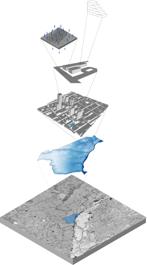
Five Scales of Intervention

Understanding Rosario's vulnerability is just the first step. The goal goes beyond simply identifying risks — it re-evaluates the tools used for urban planning in the face of a new climatic reality. At each scale, a key question is raised:

01

Regional Scale: Unfragmented Planning?

Can we move towards a more unified regional vision, strategically densifying areas less prone to flooding while considering potential migration patterns?

02

City Scale: Strategic Public Space?

Should we be designing multi-functional public spaces that can double as shelters on high ground during extreme weather events?

03

Neighbourhood Scale: De-Centralised Grids?

Can we explore de-centralised models with neighbourhoods equipped with localised resources and emergency preparedness plans?

04

Street Scale: Nature Collaborations?

Can we transition to permeable pavements and embrace 'sponge city' solutions that mimic natural water management systems?

05

Building Scale: Homes for All?

Can we advocate for affordable, resilient building materials accessible to all, alongside flexible codes that empower flood-resistant construction?

By posing these questions, the aim is to ignite a vital conversation. The future of our cities depends on our ability to adapt urban planning to a more volatile climate. Let this be the beginning of a collaborative effort to create resilient, thriving urban centres in a changing world.

The story of Rosario is a stark reminder that climate change demands action at every level. From regional planning that considers migration patterns to the design of individual streets, a holistic approach is essential. This project doesn't offer a rigid set of proposals, but rather serves as a conversation starter — a dialogue about the future of urban planning in a world shaped by extreme weather events.

Comparative scenario analysis across planning scales
Comparative Scenario Analysis · Multi-Scale Framework