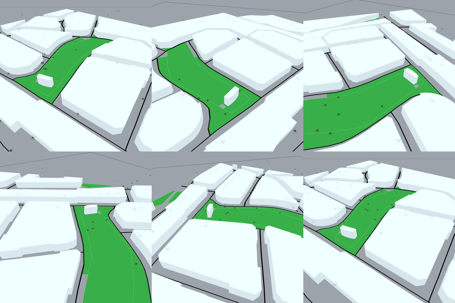
Agent Simulation: Measuring Intervention Impact
Visualizing an urban simulation of free agents affected by a tactical intervention in Viladecans, Spain, comparing pre- and post-intervention movement patterns.
The Brief
The objective of the project is to simulate the movement of people within a specific neighborhood in Viladecans, Spain, and visualize the difference in movement patterns of free agents pre-intervention vs. post-intervention.
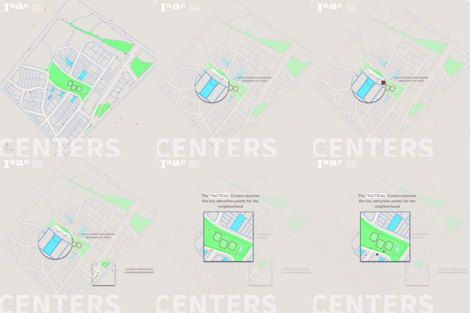
The focus is on understanding how a tactical urban intervention around a central public space can redistribute flows, attract visitors from surrounding neighborhoods, and increase exposure for local shops and edges surrounding the intervention area.
Why an Agent Simulation?
Agent-based simulation is effective for planning urban interventions due to its ability to model complex systems and capture emergent behavior at the scale of individual people moving through the city.
Each agent represents a person navigating the environment, responding to attractions, constraints, and other agents. This makes it possible to explore how small design decisions in space can ripple into large-scale changes in movement and urban life.
Key Advantages
- Granular representation — models individual entities and their interactions within an environment, capturing behaviors, preferences, and decision-making.
- Dynamic feedback loops — agents influence each other and their surroundings, leading to emergent patterns such as clustering, congestion, or new desire paths.
- Scenario exploration — rules and parameters can be adjusted to test multiple design and policy options before implementation.
- Spatialized decision-making — agents move in a virtual model of the real neighborhood, so results are legible as maps and flows, not just statistics.
- Adaptability and risk assessment — models can be iteratively refined with new data, helping to anticipate risks and unintended consequences.
- Participatory planning — animated flows and visual outputs help stakeholders understand complex dynamics and engage in more informed dialogue.
Location
The simulation is set in a specific neighborhood of Viladecans, on the outskirts of Barcelona. The model distinguishes between walkable street space and non-walkable building footprints, ensuring that simulated paths correspond to plausible routes on the ground.
This spatial grounding allows designers to directly relate agent movement to real streets, public spaces, and frontages that might benefit from tactical interventions.

The Forces at Play
Setting the Environment
Agents are first given random X & Y movement vectors, but these are constrained by an underlying binary raster that distinguishes between walkable and non-walkable cells.
To ensure agents stick to streets, the base field encodes:
- 0 — buildings and restricted spaces (non-walkable)
- 1 — streets and walkable public spaces
This keeps movement constrained to the street network and prevents agents from entering interior building cells, maintaining spatial realism.

Attractor Points and Vector Fields
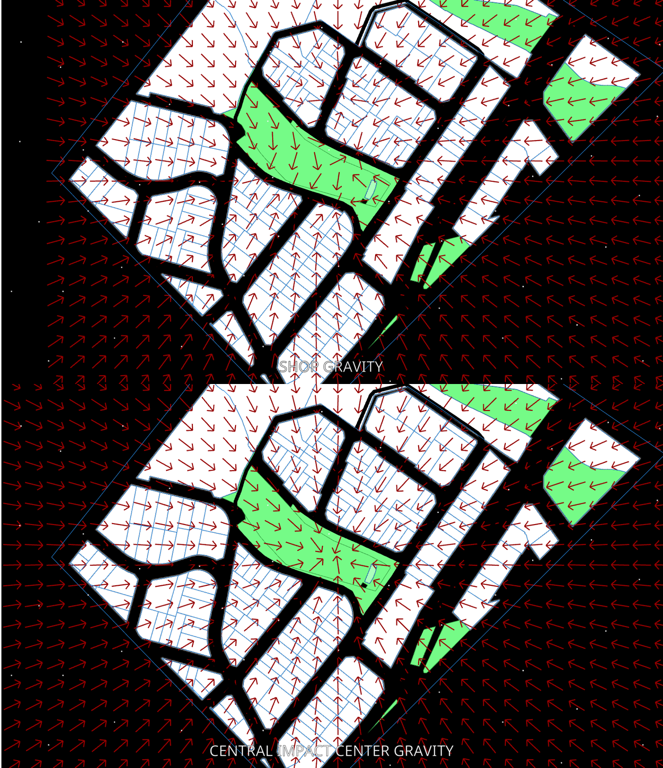
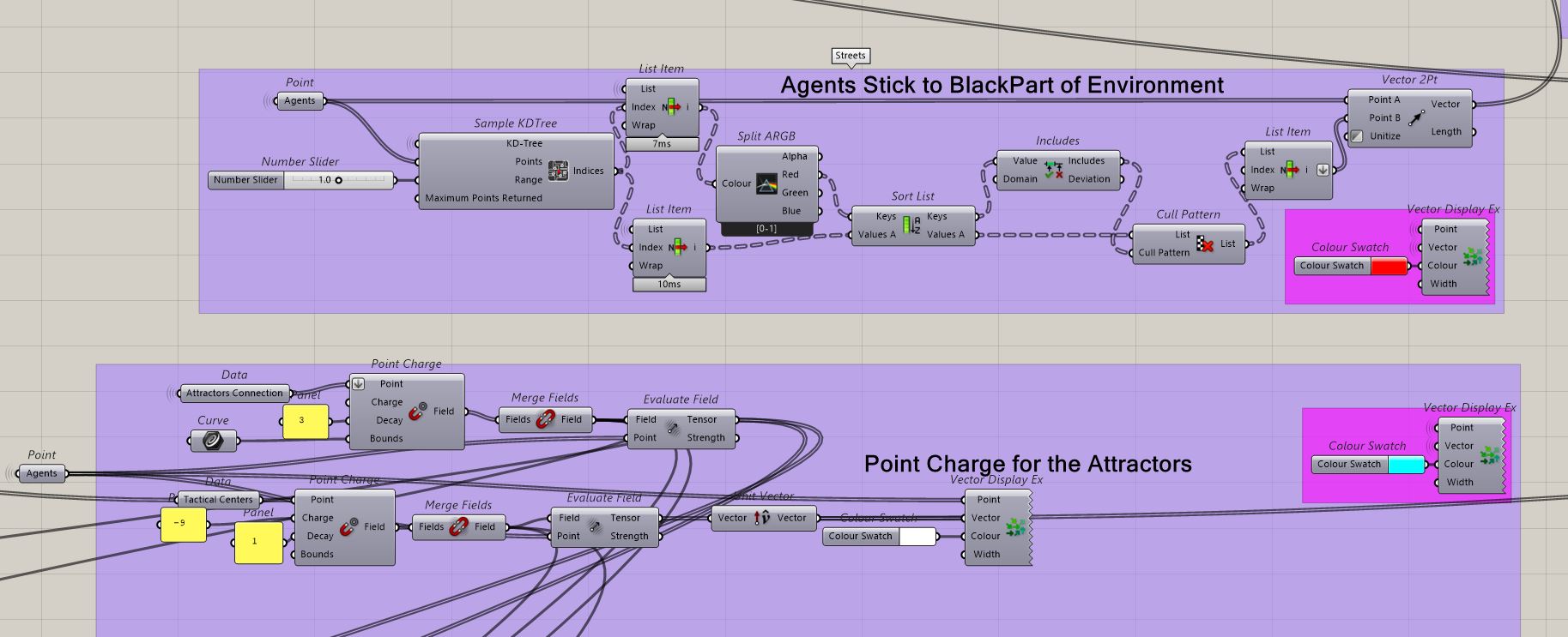
On top of the base environment, attractor points are placed across the neighborhood:
- In the baseline scenario, different shops and buildings along the central park are used as attractors.
- In the intervention scenario, the central space hosting the tactical intervention is given a stronger pull and larger reach.
Agents are more likely to be drawn into the influence radius of these attractors, revealing how a single intervention can reconfigure neighborhood-scale flows.
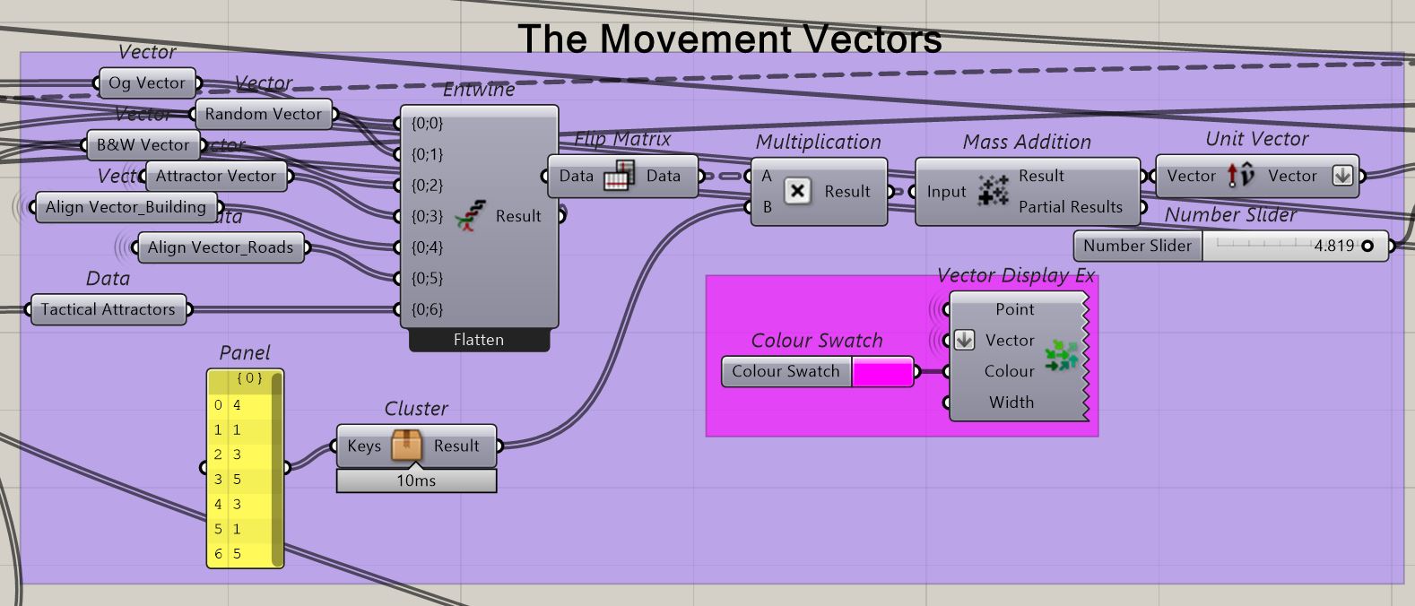
Weighted Average of Movement
The final step direction for each agent is computed as a weighted average of multiple movement vectors: random drift, attraction forces, and environmental constraints.
This blending creates smooth, plausible paths rather than abrupt, unnatural turns, and captures how people continuously negotiate between multiple competing influences in space.
The Simulation in Action
Comparing pre- and post-intervention runs shows that people—even from other neighborhoods—are drawn into the intervention area, increasing activity in and around the central space.
The increased attraction of the tactical center leads to:
- Higher flow along streets framing the intervention zone.
- Greater exposure for local shops and edges adjacent to the space.
- New paths emerging as agents reroute to include the intervention in their trajectories.
Interpreted through an urban economics lens, this pattern indicates potential uplift in business revenue and vibrancy in the immediate surroundings.
Challenges Faced
While the prototype simulation reveals useful patterns, it also exposes limitations that would need refinement in future iterations:
- Corner clustering — agents sometimes group up and get stuck in corners or dead-ends where forces compete.
- Boundary leakage — under certain parameter settings, agents may drift into buildings, indicating insufficient enforcement of non-walkable cells.
Next Improvements
If the project is extended, several improvements can turn the prototype into a robust decision-support tool for urban interventions:
- Collision and avoidance tuning at corners and intersections to reduce unrealistic clustering.
- Stronger boundary constraints so agents never enter non-walkable cells, regardless of attraction strength.
- Navigation graphs (e.g., explicit street network graphs) instead of purely field-based drift, enabling richer routing behaviors.
- Goal-driven agents with routines (home → shop → park → home) rather than purely random wandering, better matching everyday urban life.
PROJECT INFO
- Context: IAAC academic project on urban simulation.
- Location: Viladecans, Spain.
- Method: Agent-based modeling with raster-constrained movement and attraction fields.